NMEA 2000 WiFi Gateway Install R29 Classic

fishheadbarandgrill

Well-known member
Joined
Jul 15, 2018
Messages
654
Fluid Motion Model
C-288 C
Non-Fluid Motion Model
Sunfish; Vespa GTS 300 Super
Vessel Name
Sea Shanty
MMSI Number
368069690
Upgraded my R29 Classic with a Wifi Gateway today. I picked the Navlink2 product (https://digitalyachtamerica.com/product/navlink2/). I purchased a NMEA 2000 connector and added the connector to the end of the NMEA 2000 backbone located in the hanging closet in the V-berth. the Navlink2 plugged into the connector. Took about 5 minutes. Now I have NMEA 2000 data riding on my iPad. Now with Navionics and Aqua Maps I display depth and AIS targets. This is a great upgrade since I'm running a 5000 series GPSMap chart plotter from 2011.

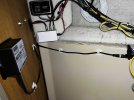
IMG_1201.jpgIMG_1200.jpg
 
I installed the same unit on my 2012 R27 a couple years ago. It is nice to have NMEA 2000 data on my iPads.

However, somewhere in the system, AIS data sent from the AIS receive capable Icom M506 VHF com radio is getting corrupted or the AIS message string is formatted in a way Aqua Maps or Navionics don’t like. The Class B targets Aqua Maps displays have random characters interspersed in the vessel name and the speed is 39 mph high. It doesn’t display ANY Class A targets. Navionics doesn’t display any AIS targets at all, Class A or B.

On the Garmin 5212 chartplotter, all AIS targets and accompanying data display fine.

What AIS receive capable radio are you using and does the AIS from it display correctly on both Aqua Maps and Navionics? This question will hopefully be moot in a few weeks. I am having a Garmin AIS 800 installed.
 
My Garmin VHF 200 radio is not AIS capable. I run the AIS 600.
 
Does this mirror the Garmin chart plotter, or can you independently see other screens?
 
Last edited:
Does this mirror the Garmin chart plotter, or can you independently see other screens?
What the wi-fi gateway does is broadcast data that is available on the NMEA 2000 network for use by any device capable of receiving wi-fi. I carry two iPads (for redundancy) that I use for primary navigation. I use Aqua Maps on one and Navionics on the other. The wi-fi gateway allows me to use the ship’s GPS on both iPads, and also allows the display of heading, depth, and AIS on the iPads. As mentioned above, presently AIS is not useable on the iPads, but that is not a fault of the wi-fi gateway. A Garmin AIS 800 being installed in a couple weeks that hopefully will resolve that issue.

EDIT: See the next post. Apparently the invalid AIS presentation IS the fault of the wi-fi gateway. I am having a Garmin AIS 800 installed in 10 days. I will update this post on how this Digital Yacht wi-fi gateway performs with that equipment.
 
Last edited:
However, somewhere in the system, AIS data sent from the AIS receive capable Icom M506 VHF com radio is getting corrupted or the AIS message string is formatted in a way Aqua Maps or Navionics don’t like. The Class B targets Aqua Maps displays have random characters interspersed in the vessel name and the speed is 39 mph high. It doesn’t display ANY Class A targets. Navionics doesn’t display any AIS targets at all, Class A or B.

On the Garmin 5212 chartplotter, all AIS targets and accompanying data display fine.
I have seen issues with this particular Wi-Fi gateway translating AIS sentences along with all other data sets, especially if an autopilot is present on the network as heading data is a high speed and high priority message type.

If I'm not mistaken the manufacturer released a software update a while back that allows for configuring the unit specifically for AIS use for apps such as that. Basically it consists of just turning off all the other nmea2000 messages except for AIS and GPS which work together just fine.

For more complete data translation I've had better luck using a Victron CerboGX connected to the backbone with the "large" firmware allowing it to be configured as a "signal k" server supplying nmea2000 data to the WiFi network.
This is the first plausible explanation of the poor/nonexistent AIS performance I have seen. Aqua Maps tech support is very good and replies promptly, but they were unable to find a solution to the scrambled AIS presentation.
 
Last edited:
I have this unit on my NMEA network. gives me data on my ipad in navionics

 
Does this mirror the Garmin chart plotter, or can you independently see other screens?
It does not mirror the chart plotter. It broadcasts any NMEA data via wifi. I haven't checked on engine data which I presume is on the NMEA network. I display AIS, and GPS data from the GPS antenna on the cabin top, vice the chip in the iPad. All this in Navionics and Aqua Maps.
 
Back
Top